Loading...
Loading...
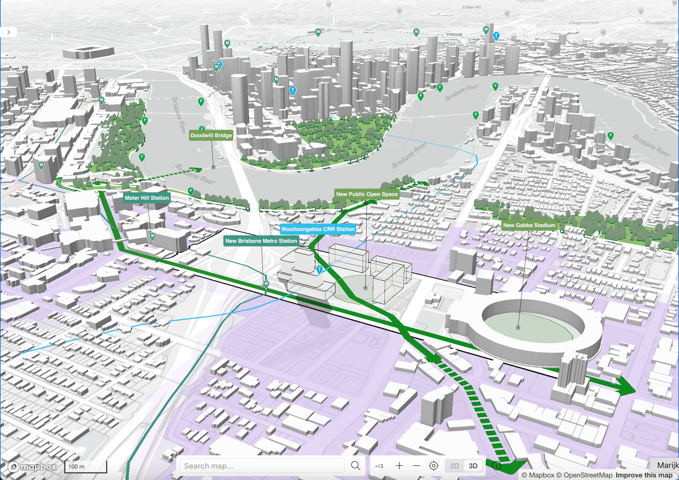
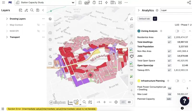
Early-stage construction and urban planning software that enables real-time design exploration, 3D building modeling, and instant project metrics to support informed decision-making during the critical project planning phase.
Primary Function
Advanced Design & ModellingSpecialization
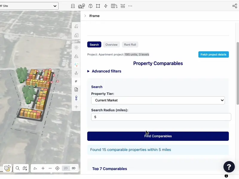
Generative Design & AI ModellingCoordinated AI-powered workflow for developers to find sites, confirm viability, model yields, and prepare investment committee materials in one platform.
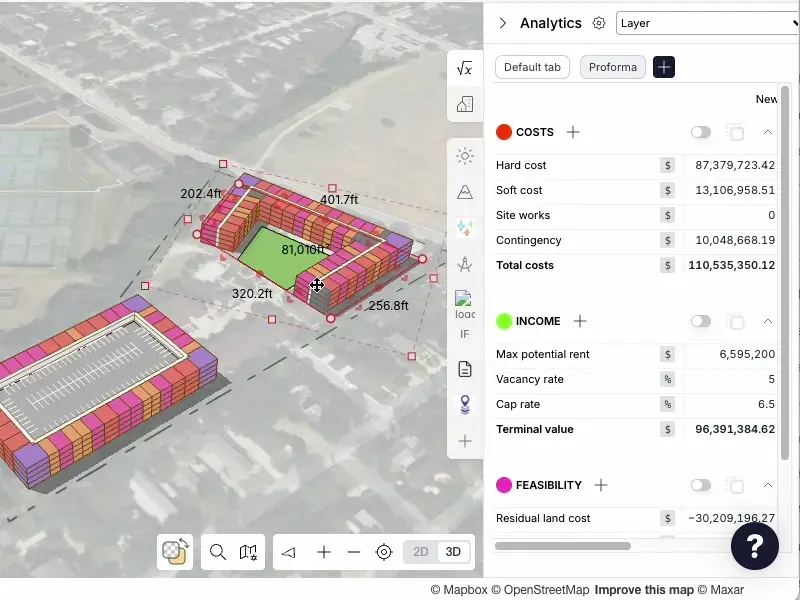
Real-time financial proforma updates as you draw site layouts, combining spatial design with instant economic validation without external tools.
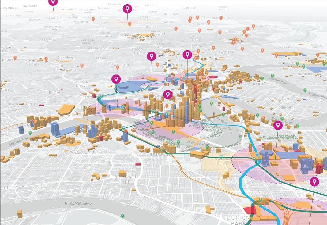
Single integrated platform combining GIS mapping, 3D modeling, and real-time analytics, eliminating need for multiple tools and reducing weeks of work to hours.
Automated site discovery tool that checks markets, zoning, and ownership status using integrated Regrid parcel data to identify viable housing sites.
No Related Posts Yet
Posts that mention or use this tool will appear here.
Sign in to leave a comment and help other users discover great tools.
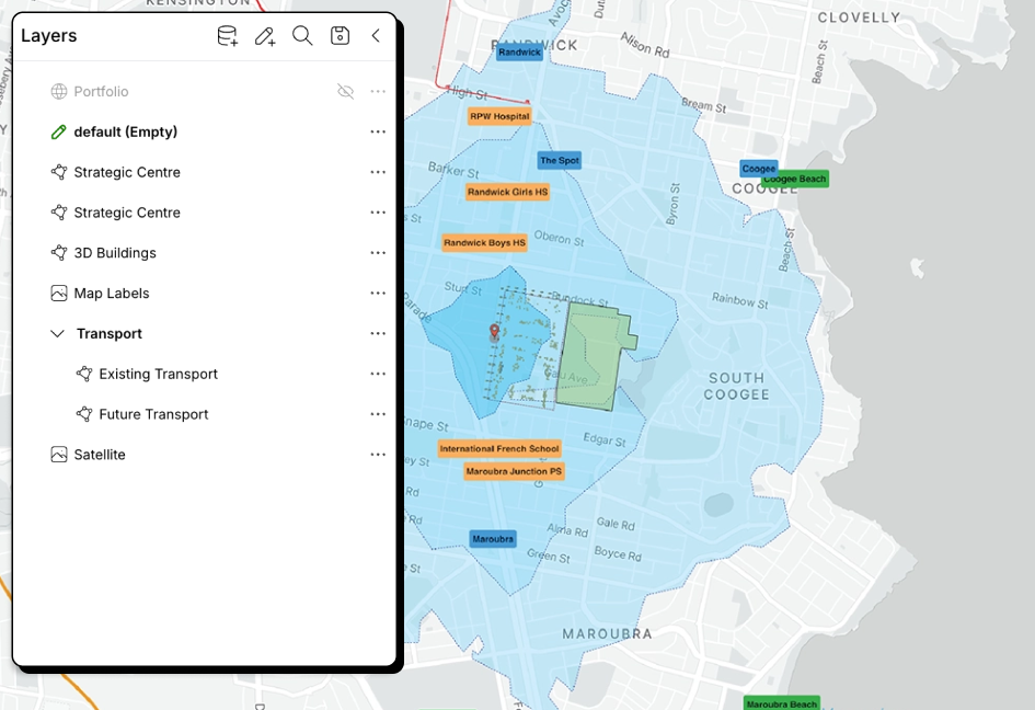
Built on a global map foundation with searchable data library of thousands of contextual layers (zoning, parcels, contours) from hundreds of cities.